Google Maps gains Gemini-powered Ask Maps and 3D navigation
Google has unveiled a major overhaul to its mapping platform, introducing a conversational AI assistant dubbed “Ask Maps” and a highly visual “Immersive Navigation” interface. The updates, announced Thursday, aim to simplify complex trip planning and provide drivers with more precise, real-world context while on the road.
Conversational AI and Personalized Planning
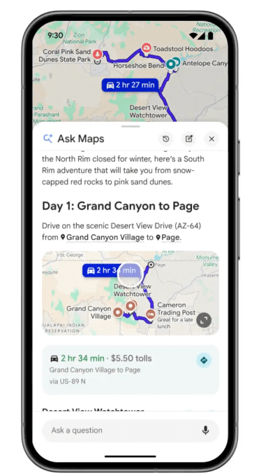
The “Ask Maps” feature, powered by Gemini, allows users to input complex, natural-language queries. Instead of searching for singular points of interest, drivers can ask for solutions to specific problems. Examples provided by Google include finding a place to charge a phone without waiting in long coffee lines or locating public tennis courts with lighting for nighttime play.
Beyond immediate needs, the tool facilitates trip planning. Users can request recommendations for scenic stops along a route or tips on finding hidden trails. The system personalizes these results by analyzing user account history, such as saved locations or past searches. If a user asks for a cozy dinner spot, the AI may prioritize restaurants aligning with the user’s previously expressed dietary preferences, such as vegan options.
Ask Maps is currently launching in the U.S. and India for Android and iOS users, with a desktop version expected in the near future.
Upgraded Visuals and Immersive Navigation
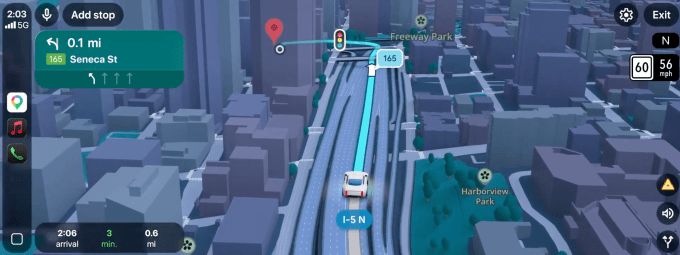
The “Immersive Navigation” update brings a significant aesthetic and functional shift to the driving experience. The app now features a 3D view that renders surrounding buildings, terrain, and overpasses, providing a perspective similar to Apple Maps. Navigation is further enhanced with:
- Road Details: Clearer visibility of lanes, crosswalks, traffic lights, and stop signs.
- Smart Zoom: A broader, dynamic view of the route with transparent building overlays to help drivers anticipate upcoming maneuvers.
- Natural Voice Guidance: Directions are now more conversational, such as instructing a driver to bypass one exit to take the next for a specific highway connection.
Real-Time Data Integration
The updated system also clarifies the trade-offs between different routes, weighing factors like speed versus toll costs. By aggregating real-time data from both the Google Maps and Waze communities, the app will provide proactive alerts regarding road construction and accidents.
Miriam Daniel, VP of Google Maps, stated that the team’s core objective was to remove the guesswork from the driving experience. “Immersive navigation is a complete transformation of the navigation experience. It’s got redesigned visuals, fresh real-world information that’s brought to you just in time, and more intuitive guidance,” Daniel said during a press briefing.
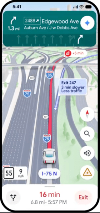
Immersive Navigation is rolling out across the U.S. today, with plans to expand to additional iOS and Android devices, as well as CarPlay and Android Auto integrations, over the coming months.